 Geobru catalogue
urban design
Type of resources
Available actions
Topics
INSPIRE themes
Keywords
Contact for the resource
Provided by
Formats
Representation types
Update frequencies
Scale
-
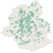
Brussels-Capital Region: location of the buildings winning the "Exemplary Buildings" calls for proposals organised with the aim of encouraging initiatives in eco-construction and integrated renovation. In order to be selected, winners must fulfil a series of criteria with regard to energy and management of water and waste, but also comfort and aesthetics, all while remaining financially accessible for the Brussels market. The dataset contains the number and name of the projects, and a link to an description factsheet.
-
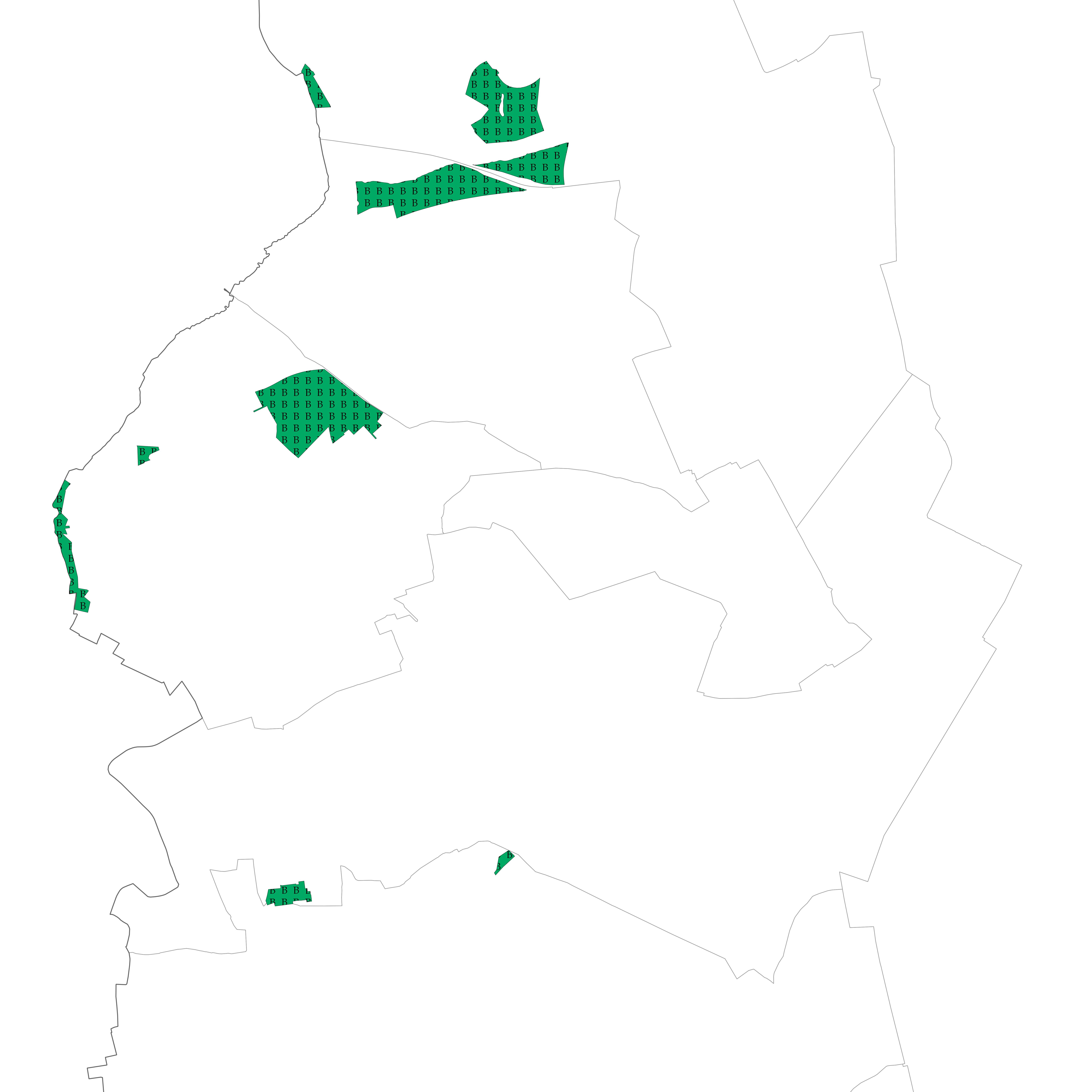
Brussels-Capital Region : Areas intended for the conservation and the regeneration of a natural environment that is of high biological value as it shelters rare animal and vegetable species or boasts considerable biological diversity
-
Vue des UTG (unité technique et géographique) pour les PE
-
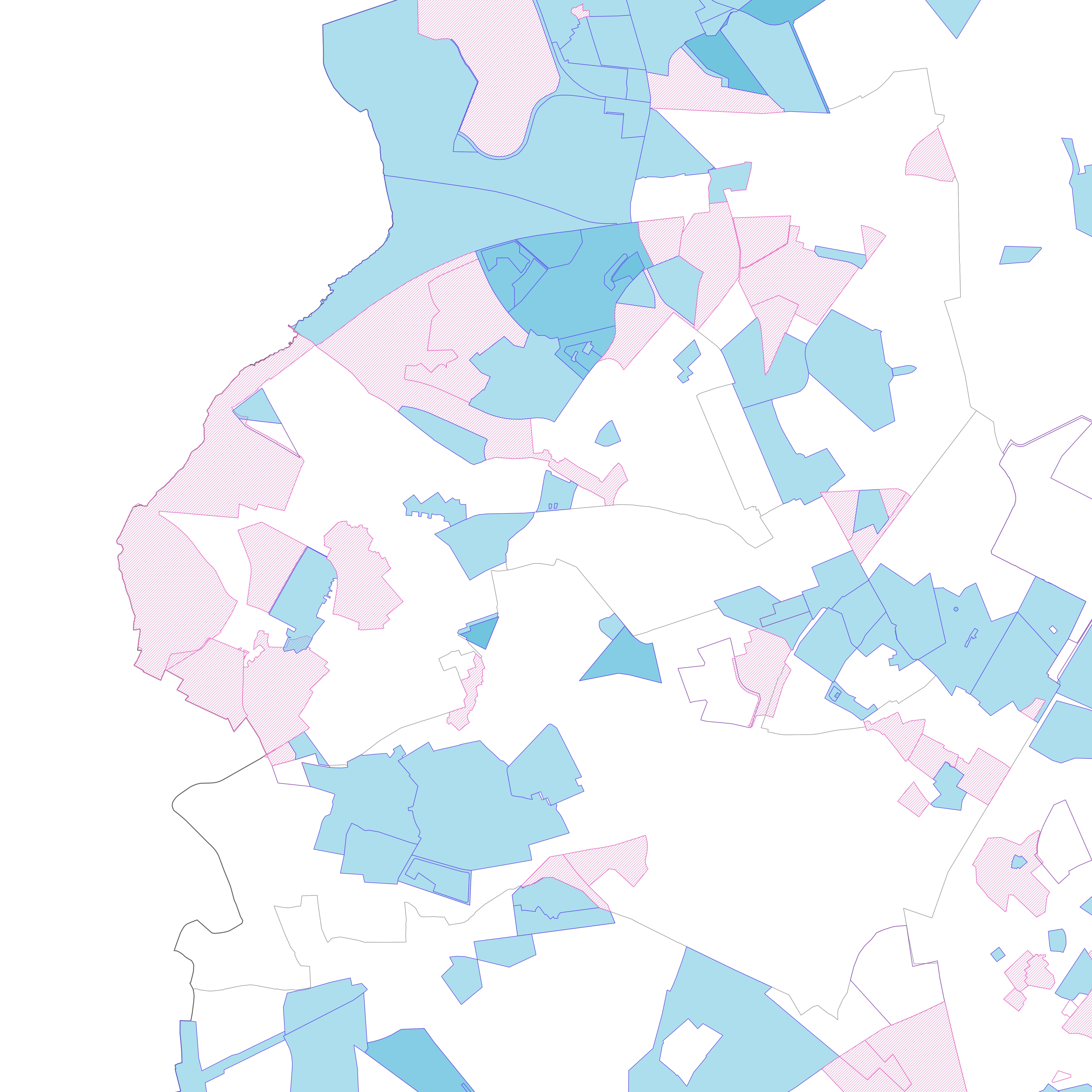
Section of the municipality's territory with a particular use of the land, as stipulated by graphical and written regulations, authorised by decree
-
Brussels-Capital Region : "any particularly remarquable building, including installations or decorative elements being a constitutive part of it" having been the subject of a decree for its conservation
-
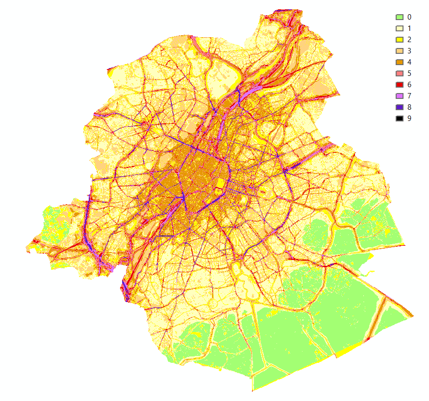
Brussels-Capital Region : This map shows the combined Health Impact Screening score for heat stress, air pollution and noise pollution (0-9) in the Brussels Capital Region. It was produced as part of the 2020 study on the "Impact of 'Nature-Based Solutions' (NBS) on urban residents' exposure to air pollution, noise pollution or high temperatures - Overview of general knowledge and recommendations for the Brussels-Capital Region". This map is a combination of 3 maps: heat stress (24/08/2016), air pollution (2018) and noise pollution (2016). For the methodology used, see p.54. The study report (in dutch) is available at http://document.environnement.brussels/opac_css/elecfile/NatureBasedSolutions
-

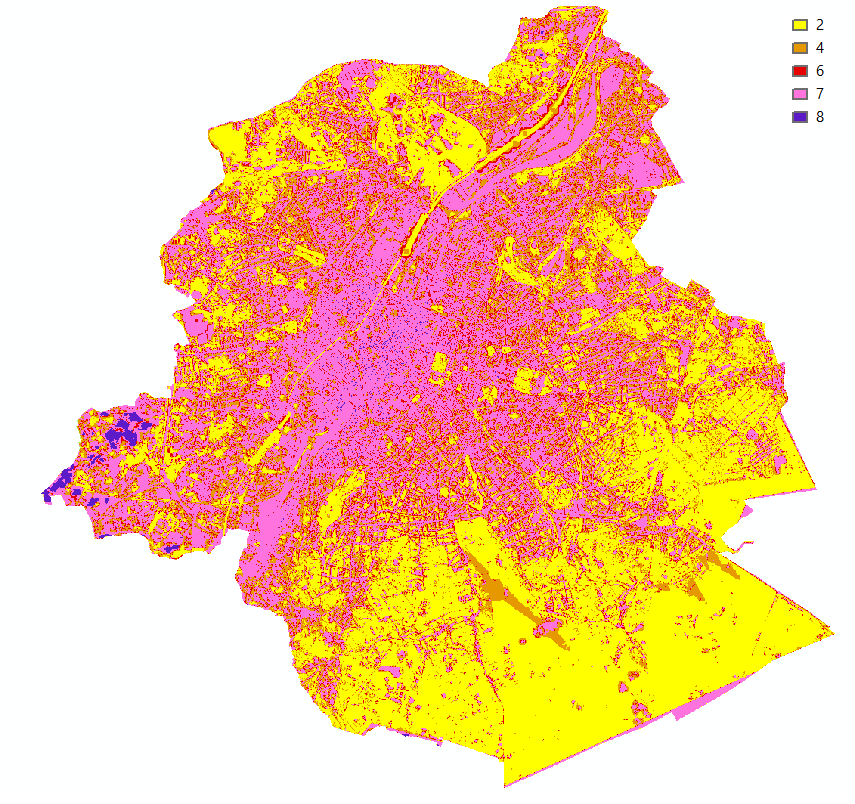
Brussels-Capital Region : This map shows the Health Impact Screening score for air quality (0-8) in the Brussels Capital Region. It was produced as part of the 2020 study on the "Impact of 'Nature-Based Solutions' (NBS) on urban residents' exposure to air pollution, noise pollution or high temperatures - Overview of general knowledge and recommendations for the Brussels-Capital Region". This map is based on the 2018 annual average nitrogen dioxide concentration map. For the methodology used, see p.49. The study report (in dutch) is available at http://document.environnement.brussels/opac_css/elecfile/NatureBasedSolutions
-
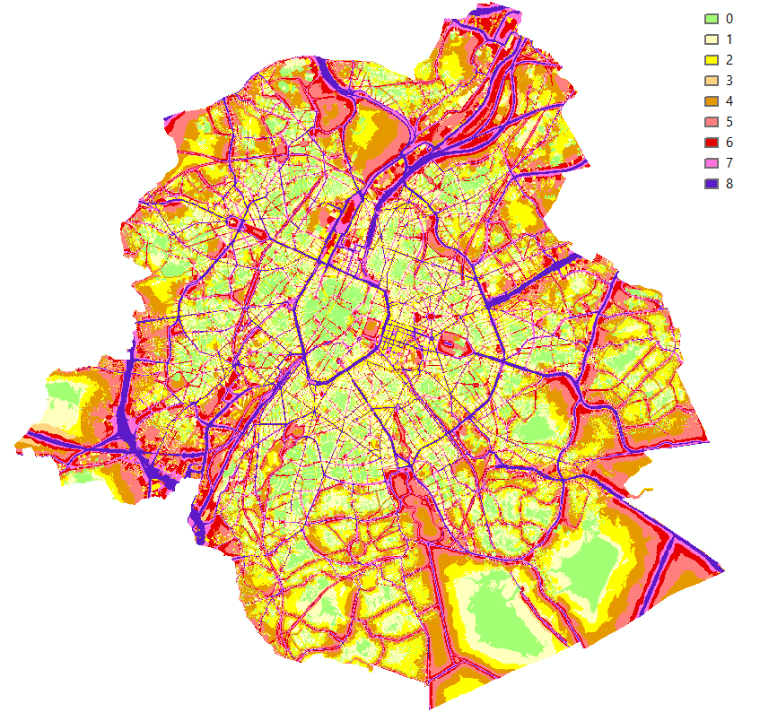
Brussels-Capital Region : This map shows the Health Impact Screening score for heat stress (0-8) in the Brussels Capital Region. It was produced as part of the 2020 study on the "Impact of 'Nature-Based Solutions' (NBS) on urban residents' exposure to air pollution, noise pollution or high temperatures - Overview of general knowledge and recommendations for the Brussels-Capital Region". This map is based on the maximum Wet Bulb Globe Temperature (WBGT) map of 24 August 2016. For the methodology used, see p.48. The study report (in dutch) is available at http://document.environnement.brussels/opac_css/elecfile/NatureBasedSolutions
-
Brussels-Capital Region : This map shows the Health Impact Screening score for noise pollution (0-8) in the Brussels Capital Region. It was produced as part of the 2020 study on the "Impact of 'Nature-Based Solutions' (NBS) on urban residents' exposure to air pollution, noise pollution or high temperatures - Overview of general knowledge and recommendations for the Brussels-Capital Region". This map is based on the 2016 noise pollution maps for road traffic and rail traffic. For the methodology used, see p.51. The study report (in dutch) is available at http://document.environnement.brussels/opac_css/elecfile/NatureBasedSolutions